Lawsuit Filed Against Spring Valley Wind Project
January 25, 2011 - Western Watersheds Project, Center for Biological Diversity, Confederated Tribes of the Goshute Reservation, the Duckwater Shoshone Tribe, and the Ely Shoshone Tribe filed suit today to protect a pristine mountain valley adjacent to Great Basin National Park in Nevada from a poorly-sited 8000 acre industrial wind energy project, approved by the Department of the Interior with only a short Environmental Assessment instead of a longer and more throrough Environmental Impact Statement.
“We hope this litigation will lead the federal government to choose less damaging locations for wind power developments,” said Jon Marvel, executive director of Western Watersheds Project.
“Renewable energy is nationally and globally important for addressing the growing threats from climate change,” said Rob Mrowka, an ecologist with the Center for Biological Diversity, one of the parties in the suit. “But, renewable projects must be properly located with careful consideration of the values of not only the site but also of the surrounding area...The best ways to avoid negative impacts of renewable energy projects are to carry out a thorough environmental review and site them carefully. Unfortunately, in this case BLM did neither.”
One of the more critical negative biological impact of the project will be on the 1 million Mexican free-tailed bats that roost in the Rose Guano Cave near the project area. This cave is one of the most important known roosts in the Great Basin. A growing body of science demonstrates that wind turbines can kill bats by the thousands through the phenomenon known as “barotrauma,” in which the pressure difference created by wind turbine blades causes bats’ lungs to explode.
“Biologists believe that the populations of bats that roost in Rose Guano Cave may migrate from Texas, Mexico and beyond,“ said Katie Fite of Western Watersheds Project, “the impact of this wind farm to these bats will negatively affect these bats’ important role in ecosystems all over the southwest.”
The Spring Valley Wind Energy Facility would include 75 turbines and 25 miles of new roads on public lands - just 4 miles from the Rose Guano Bat Cave in eastern Nevada.
Golden eagles and other bird species that inhabit or migrate through Spring Valley are also put at risk by the project, as wind turbines are known to kill or dismember birds through collisions with turbine blades.
The area is historically and culturally significant as the site of a massacre and a US Calvary and Native American war.
Plaintiffs Western Watersheds Project and Center for Biological Diversity will be represented by Advocates for the West, a Boise-based environmental law firm.
http://www.biologicaldiversity.org/news/press_releases/2011/spring-valley-01-25-2011.html
http://www.lasvegassun.com/news/2011/jan/25/groups-sue-feds-over-plans-nevada-wind-energy-farm/
Spring Valley Wind Project
UPDATE July 20, 2010: The Environmental Assessment is out on the Bureau of Land Management (BLM), Ely, Nevada website >>here, which will have only a 30-day comment period. Remember, the Daggett Wind Ridge project is only just over 1,000 acres and the Granite Wind Energy Project is just 29 turbines and both of these projects have full Environmental Impact Statements. This one is 8,000 acres with over 80 turbines and will only have an Environmental Assessment. More Updates >>here.
The 30-day formal public comment period concludes at 5 p.m., on Wednesday, Aug. 18, 2010. Interested individuals should address all written comments to the BLM Ely District Office, HC 33 Box 33500, Ely, NV 89301, ATTN: Project Lead Gina Jones. Comments may be submitted electronically to springvalley@blm.gov.
We have several concerns with this project, which are very well addressed in a comment letter by the Center for Biological Diversity >>(1.87 MB PDF file).
January 1, 2010 - Ely, Nevada - By L. Cunningham and K. Emmerich
 The Bureau of Land Management (BLM) Ely District released the Spring Valley Wind Project Draft Environmental Assessment (EA) for public comment (here is the link to the BLM page). This should be a full EIS (Environmental Impact Statement, which would be a more full analysis, and give the public longer comment periods). There is a lot of wildlife and rare habitats at this site, and an EA does not do this justice.
Spring Valley Wind, LLC, a subsidiary of Pattern Energy of San Francisco, is proposing to build Spring Valley Wind Project, a 149.1 megawatt wind generation farm that would be constructed on 8,565 acres of the public lands in north Spring Valley, about 30 miles east of Ely. The project would consist of from 66 to 85 wind turbines and a new electrical substation. It would utilize an existing 230 kilovolt (kV) transmission line for distribution. On our site visit in November 2009, we noticed that, like all renewable energy projects we have seen, the first choice by the developer is proximity to existing powerlines. Last on the list are biological and cultural resources. Vegetation would be cleared, bulldozed, and grading would be done for buildings and switchyards.
Comments Needed
Copy and paste the letter below to send, make changes if needed. Send all written comments to the BLM Ely District Office, HC 33 Box 33500, Ely, NV 89301 attn: Project Manager Wells McGiffert. Comments may be submitted electronically to springvalley@blm.gov
Please accept the following comments on the proposed Spring Valley Wind Project: Environmental Assessment DOI-BLM-L020_2010-007-EA.
The Environmental Assessment (EA) is a very incomplete document. It fails to directly address many of the scenic, cultural, and biological impact a project of this size could inflict on the area. Most of the important issues are only referenced in the EA and what little information that is provided is inconsistent with some of the reports that the applicant's consulting surveyors have written. The attempts to "Fast-Track" the project are frivolous and could result in the unnecessary loss in visual, water, biological and cultural resources. A full Environmental Impact Statement should be required from the applicant for the following reasons:
1. The project will be constructed within one mile of the Rose Guano Cave; an important roosting colony for over one million Brazilian free-tailed bats. The applicant's own biological report states that "the fate of this colony could be profoundly impacted," but the EA states that the impacts would be minimal. Due to peer reviewed studies that have revealed high numbers of bat mortalities world wide, it is clear that BLM does not have enough information to approve this project.
2. The EA provides little information on avian mortality and the applicant's biological report has a very incomplete list of potential species that could be impacted by this project.
3. The EA provides no information of the potential impacts that heavy concrete foundations and excavations could have on the delicate hydrology of the directly adjacent Swamp Cedars Area of Critical Environmental Concern.
4. The EA has virtually no information on impacts the project would have on Pronghorn antelope, Elk and Mule deer.
5. The EA fails to adequately address the impacts the project would have on sensitive species such as the Greater sage grouse and Pygmy rabbit. More information is needed on how removal of sagebrush habitat, construction of roads and fiber optic lines, use of herbicides, and general fragmentation of habitat will impact these two species. BLM says that this information is contained in the Programmatic Environmental Impact Statement (PEIS) for Wind Energy, but this should be automatically provided to the public in an easily accessible place next to the Spring Valley EA; otherwise it must be searched for.
6. The EA states there is only one sage grouse lek on the site while the applicant's biological report states there are three.
7. The EA states there are Native American burial sites in the project area, but has NO other information on cultural resources.
8. The EA fails to even mention the impacts the project would have to the visual resources in the area. No mention is made of the adjacent Mt. Moriah Wilderness Area or Great Basin National Park. How would these areas be impacted? Why are there no photo simulations? How many lights would be used after dark? How would this impact the night sky?
9. There is very little information on the two alternatives that were considered. Please provide an additional alternative that the public would be allowed to review.
Thank you,
(Your name)
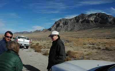
We discussed the matter of bats and wind turbines with Ely BLM personnel on a site visit on November 17, 2009. Wells McGiffert, Renewable Energy Coordinator for the Ely BLM office, and Mary D'Aversa, Field manager of the Schell Field Office met us, along with Katie Fite from Western Watersheds Project (photo left).
The Ely district has 17 renewable applications, but McGiffert said many of them may be speculators.
More wind projects are proposed for north of this site in Spring Valley, two "on top of each other."
We all asked BLM why this large wind project will just have a small Environmental Assessment, rather than a lengthier Environmental Impact Statement. They told us they are still getting information, and could decide to make it an EIS.
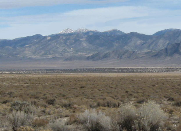
The issues are many here: the 400-foot-tall turbines would be in the viewshed of Great Basin National Park (Wheeler Peak is clearly visible from the site), impacts to bats, three Greater sage grouse leks within a few miles of the project, Pygmy rabbit foraging and burrow habitat in the project site, antelope, deer, and elk habitat impacts, groundwater pumping, affects to the unique wetlands adjacent to the site, and others. The EA states: "there is a potential effect on Native American burial sites" (page 5).
McGiffert told us the applicant contracted a Visual Resources report, sending people even up to the top of Mt. Wheeler. The visual impacts were "a lot less significant than you would think," he said. Great Basin National Park is about 5 miles from the project site.
The exact model of turbine has not yet been chosen, but would be a Siemens 2.3 MW or 1.8 MW Vestas or 2.0 MW RePOWER type, about 425 feet tall in total. Height would be around 400 feet. Rotor diameter is about 300 feet.
Lighting on the turbine tops might be a kind activated by airplane fly-bys. Most turbines would have red flashing lights. How will this affect views from the park?
D'Aversa said the wind company gets a three-year study period, then must drop out or go ahead with the project.
We asked why Nevada does not have a brownfields program, like Arizona BLM has, where the public can participate in siting cases for renewable, and suggest sites that are disturbed. This Spring Valley area was definitely not disturbed.
McGiffert said they were looking at such a program, and looking at such areas as past fire disturbances where restoration efforts do not seem to be working (we would disagree that a wildfire could not restore over time -- this is not a good idea for renewable industrialization). BLM was also looking at mines in the state. Wind companies found that mine tailings had a poor substrate for turbine foundations, however.
Katie Fite asked whether this company has any plans to build water storage batteries, which are being proposed in Oregon: water would be pumped out of lakes by the wind or solar plant and into a reservoir -- at night this "stored capacity" could be released, turning turbines to generate electricity. Needless to say this would have drastic impacts on local water resources. BLM said there are no plans like this for Spring Valley.
Fite persisted -- this is just the tip of the iceberg, she pointed out. NV Energy has the whole Spring Valley mapped out as a vast wind energy zone.
We asked what "Fast-Tracking" really involves for a renewable project. Is public involvement curtailed? Both BLM employees assured us that Fast-Tracking involves putting staff onto priority projects, not sidestepping NEPA.
We pointed out that the public would like to be more involved, including the chance to say that such a large wind project shouldnot be placed right next to an Area of Critical Environmental Concern.
D'Aversa said the BLM has the latitude to go back and reconsider amending the EA, and having a second scoping period.
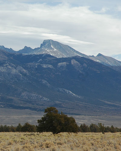
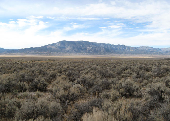
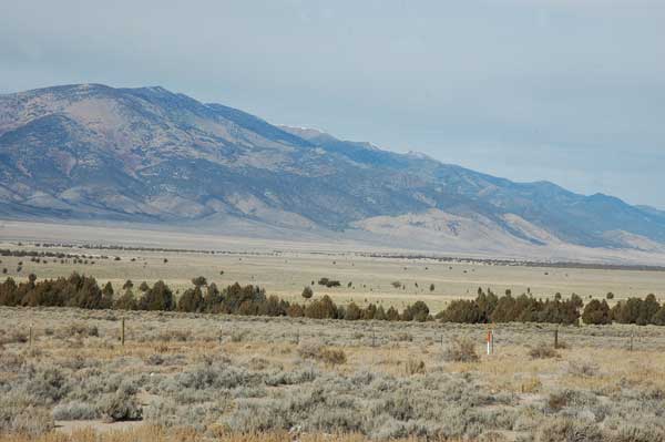
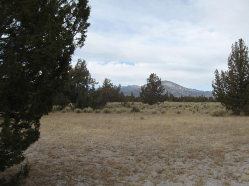
>Mt. Wheeler in Great Basin National Park from Swamp Cedar ACEC right next to the project site.
The wind project would need 30 acre-feet of water for construction, mostly for dirt road maintenance and for making the cement for the large foundations for each turbine. Southern Nevada Water Authority holds most of the allotments, but Pattern Energy would probably lease water rights from the Church of Latter Day Saints, which owns grazing allotments on the site. An cattle would have to be moved until after the project was built.
Fite suggested as mitigation for the wind impacts, why not retire the grazing allotments? McGiffert said little mitigation needed to be done. That is why they are doing an EA, as this project has "little impact." We all disagreed.
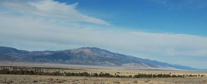
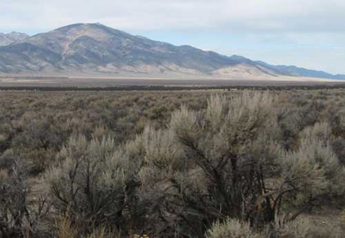
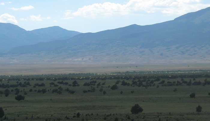
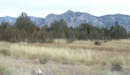
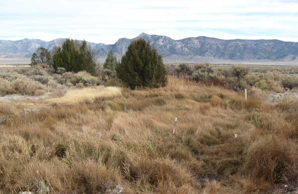
^View of Mt. Moriah Wilderness from the project site. Swamp Cedar ACEC lies in the distance on the valley.
Bat Cave
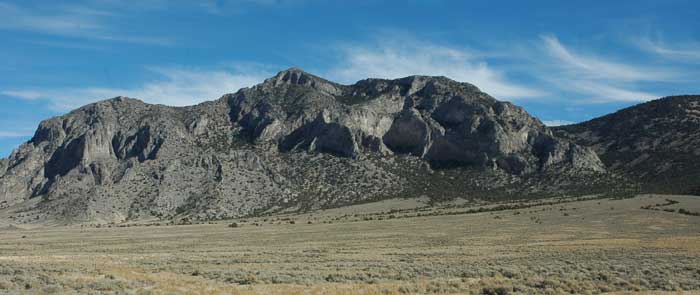
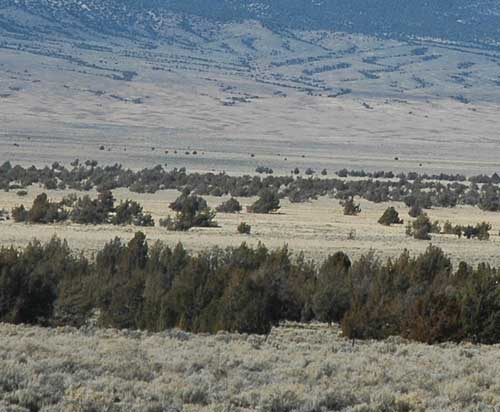
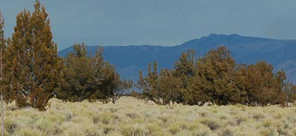
^Rose Guano Cave lies on the right in this foothill area of the Snake Range, near the Great Basin National Park boundary.
We drove out to the site on a cold November morning to look at an amazing view and unique bat roosting cave in the Snake Range next to the proposed wind farm. Rose Guano Cave lay high on a limestone cliff, only a few miles from the proposed field of giant wind turbines with their moving rotors.
The Nevada Division of Wildlife became interested in impacts to the bats by the wind project, and in cooperation with BLM and the applicant, a study was contracted with Dr. Richard Sherwin of Christopher Newport University in Virginia in 2008.
Using thermal imaging cameras, Sherwin found an impressive southward migration in mid and late August as Brazilian free-tailed bats (Tadarida brasiliensis) crowded into the cave. Later into September as cave air cool, the bats roost in smaller numbers on overhanging crevices on nearby cliffs. He estimated that over 1 million bats used the cave in migration annually.
Hundreds of thousand of bats could be seen in a plume exiting the cave above 800 feet, many dropping to the valley floor to forage on insects. The plume looses cohesion at 12 miles out, as individual bats spread out: the entire Spring Valley is occupied each night in August and September during nightly forays.
Primarily adult bats use the roost, and the females caught were post-lactating, having given birth elsewhere. The cave is a migratory stop-over, bats staying for a few days, then moving on and replaced by more migrants. Bats begin leaving the cave slightly before sundown, the outflight continuing for tow hours. Small groups of bats were seen flying west and north over Spring Valley (apparently over the proposed wind project area), while others flew south towards agricultural fields to forage. Migratory flight was typically at 800 to 2,500 feet above sea level, while foraging flight was lower. The majority of bats foraged at night in the valley or along the margins of the mountains before returning to the cave, as early as 3:00 AM. Other bats roosted elsewhere nearby, or continued their southward migration.
The cave is occupied as early as June. On July 15, 1994, 600 bats per minute were seen for over two hours exiting the cave.
Sherwin concludes, "it is clear based on radar and radio telemetry data that many individuals are active at low elevations throughout Spring Valley, including the landscape immediately surrounding Rose Guano Cave. Similarly, the single night movement of some radio tagged bats to the Wilson Creek Mountains (roughly 40 miles south of the cave) reveal that these animals are functioning at a larger spatial scale than we had previously supposed and that the fate of this colony could be profoundly impacted by habitat perturbations that occur at larger distances from the cave itself" (page 25-26). Sherwin summarized: "...the entire Spring Valley area receives high levels of bat activity each night, with individuals foraging and accessing water at low altitudes, and commuting at higher altitudes" (page 27).
Sherwin also notes, "This prolonged association with a site that is at the periphery of the species range, and whose use therefore invokes some degree of energetic costs, certainly indicates that this location is of biological significance and warrants managerial attention" (page 3).
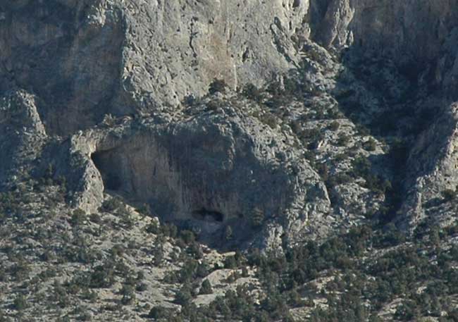
^Rose Guano Cave, an important migratory stop for over a million Brazilian free-tailed bats.
According to Paul Cryan of the USGS Fort Collins Science Center, "Bat fatalities have now been documented at nearly every wind facility in North America where adequate surveys for bats have been conducted, and several of these sites are estimated to cause the deaths of thousands of bats per year."
Bats especially affected are those with large seasonal movements, that concentrate in certain areas during migration periods -- such as caves. Brazilian free-tailed bats (also called Mexican free-tailed bats) have been found to be disproportionately affected by wind turbines (Arnett et al. 2008).
What would BLM to reduce these impacts or mitigate for bats deaths? we asked. D'Aversa said mitigation would be a "design feature," meaning nothing will be done now, but only later (after bats have started dying). Two years after construction of the wind farm, "intensive mortality studies" will be undertaken. Katie Fite pointed out this was not mitigation, but only adaptive management. We laughed. Would NV Energy really agree to cut turbine operation because of bat mortality? McGiffert responded that BLM is curious, and Nevada Division of Wildlife wants the data.
Bat "carcasses will be removed from the site," says the EA (page A-2).
The EA states that the company would avoid lighting that attracts bats and birds, but no details are given.
Other bats found in the area include: Townsend's big-eared bat (Plecotus townsendii), Big brown bat (Eptesicus fuscus), Western red bat (Lasiurus blossevillii), Hoary bat (L. cinereus), Silver-haired bat (Lasionycteris noctivagans), Western small-footed myotis (Myotis ciliolabrum), Long-eared myotis (M. evotis), Long-legged myotis (M. volans), Yuma myotis (M. yumanensis), and Little brown bat (M. lucifugus).
See more on bats and wind farms >>here.
Sage Grouse, Pygmy Rabbits, Antelope
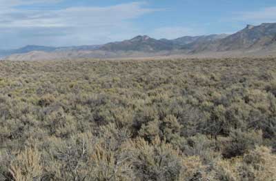
^We follow BLM through one of the few dirt roads through the site. If permitted, many more miles of roads would be graded into these habitats. The site was obviously placed here for the existing powerlines, with no regard for biological resources.
Horned larks rose from the valley floor, which had a mosaic Big sagebrush (Artemisia tridentata), Black sagebrush (A. nova), Greasewood (Sarcobatus vermiculatus), Winterfat (Krascheninnikovia lanata), Nevada ephedra (Ephedra nevadensis), Shadscale (Atriplex confertifolia), Four-wing saltbush (A. canescens), Yellow rabbitbrush (Chrysothamnus viscidiflorus), and Rubber rabbitbrush (C. nauseosus). Grasses were scattered among the shrubs: Indian ricegrass (Achnatherum hymenoides), Needle-and-thread (Hesperostipa comata), Alkali sacaton (Sporobolus airoides), Galleta grass (Pleuraphis jamesii), and Great Basin wildrye (Leymus cinereus).
A raptor nest sat on one of the powerline poles, in the middle of the project site. During turbine operation, any raptor nests within a half-miles would be removed.
Other birds found in the area include Prairie falcon, Ferruginous hawk, Golden eagle, Northern harrier, Swainson's hawk, Western burrowing owl, Long-eared owl, Long-billed curlew, Willet, Greater sandhill crane, Red-naped sapsucker, Pinyon jay, Juniper titmouse, Loggerhead shrike, Sage sparrow, Vesper sparrow, and Brewer's sparrow. Bald eagles commonly winter in the area.
No surveys for rare plants were undertaken on the site, only a few casual observations. Parish's phacelia (Phacelia parishii) has the potential to be found on the site, as records of it are found 250 feet from the project boundary. It is found on clay and alkaline soils by the playas and springs.
Cement foundations for each turbine will be made on site using a new 5-acre cement batch plant. Gravel would be trucked in from an existing mine tailings pile nearby and will also be taken from a new 10-acre gravel pit on the site. The turbine foundations would be 8 feet deep into the ground. The turbine base diameter is 15 feet. Each turbine would require a 400-foot diameter (2.9 acres) temporary construction pad for the crane to lift the steel tower. This area would be bulldozed, graded, and compacted to level. Each foundation would use 400 tons of gravel, 250 tons of sand and 120 tons of cement.
No new water rights are available in Spring Valley, so temporary leases will be obtained from LDS Church's rights north of the site (is this the spring we photographed? -- see below). Up to 200,000 gallons a day would be pumped to make cement for turbine foundations and buildings pads and road maintenance/dust suppression. Water use may be up to 30.7 acre-feet.
Access roads would be built, 28-feet wide (with temporary disturbance up to 68 feet wide total) for large trucks and cranes. A total of 27.5 miles of new roads would be constructed in this valley. Final roads would be surfaced with gravel. Electric cables and fiber-optic lines would be undergrounded between turbines in trenches, creating more disturbance.
The turbines will not be fenced. A 7-foot chain-link fence would surround the new operations and maintenance building and substation (20 acres) to keep out "unauthorized wildlife" and people.
A 100-foot tall microwave tower would be put up at the new Osceola substation next to the new switchyard. Connection would be to NV Energy's line.
Herbicides will be applied to the areas around the turbines bases to control weeds.
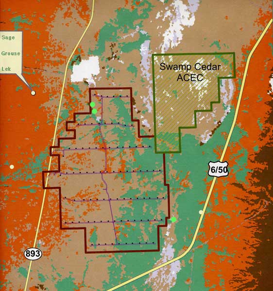
^Map of Spring Valley Wind Project proposal, east of Ely, Nevada. Greater sage grouse leks are represented by yellow dots; Pygmy rabbit burrows by green dots (Source: SWCA 2009). Green is Inter-Mountain Basins Sagebrush Shrubland. Tan is Mixed Salt Desert Scrubland. Orange is Great Basin Xeric Mixed Sagebrush Shrubland. Pink is Inter-Mountain Basins Greasewood Flat. White is wetlands and other habitat, although this map appears to leave out much seasonal wetland, spring and marsh habitat that we saw on a field visit. Brown is Great Basin Pinyon-Juniper Woodland. The Rose Guano Bat Cave lies in the brown color area just off the right edge of the map.
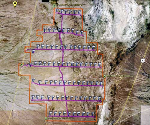
^Turbines portrayed on an aerial photo. The wetlands of Swamp Cedar ACEC are visible as whitish areas on the upper right. New roads are in purple. The yellow pin in the upper left is one Sage grouse lek, but BLM left out the other two in this image.
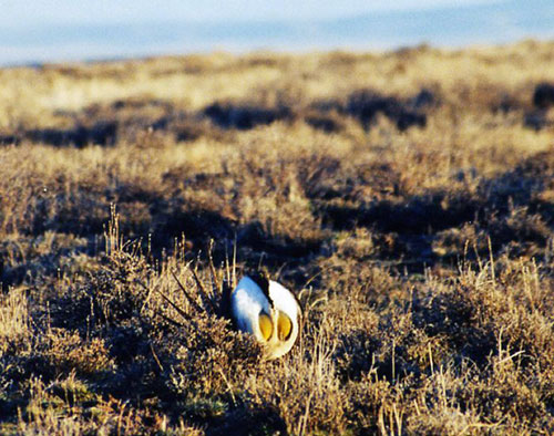
^We photographed this male Greater sage grouse on a lek in Oregon near Malheur National Wildlife Refuge. The area is a display "dance-ground" for males to attract females, which wander through the short sagebrush and grass. Sage grouse need large undisturbed areas of sagebrush, not cut by roads or fences, to nest and feed in. The impacts of industrial wind farms in sage grouse habitat will involve further fragmentation of the large patches of pristine sagebrush that harbor these birds. There is about 3,643 acres of sage grouse habitat within the project site.
The only mitigation offered is that the company would not construct turbines closest to the lek on the northwest side during sage grouse breeding activities. Turbines would not "where possible" be located within two miles of active leks. This is unacceptable. Will operations of this facility and fragmentation of foraging habitat cause lek abandonment? "Green" energy has priority over wildlife apparently.
^Swamp Cedars habitat next to the site.
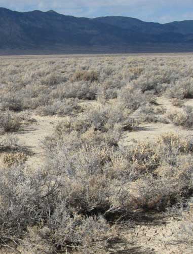
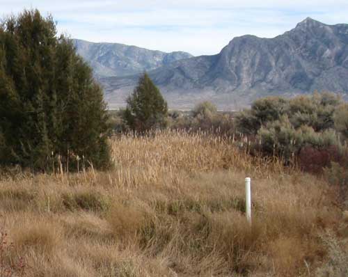
^Big sagebrush on the site looking west towards the Schell Creek Range. Elk herds summer in the higher mountains and winter on the basin and foothills.
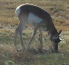
^Pronghorn antelope. The entire project site is within antelope year-round range. Katie Fite saw a herd running by the Swamp Cedars ACEC, on the morning of our meeting with BLM.
^Greasewood habitat, a seasonally moist or wet basin shrub community. This is on the project site.
^Winterfat, a Northern Hemisphere shrub also found in Russia, adapted to Ice Age cold and arid climates.
^This dense sagebrush could be Pygmy rabbit habitat. On the site.
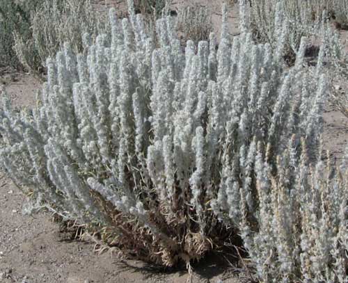
^Thick Big sagebrush on the site.
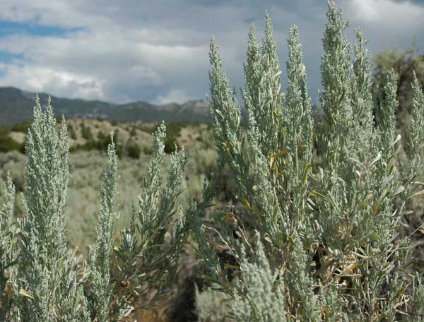
^Big sagebrush in bloom in summer.
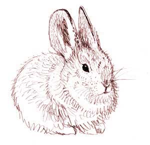
^Pygmy rabbit. Biologists mapped two burrows of this small animal in the northern part (SWCA 2009). These small herbivores require tall dense sagebrush stands to hide from predatory hawks and eagles. At least 3 individuals were seen in 3 separate habitat patches in the project site. About 89 acres of good habitat for this rabbit, and 61 acres of occupied habitat with active burrows were found on the project area. The EA states that is it hoped that the Pygmy rabbits will move away, "to avoid mortality associated with daily operations such as crushing by vehicles" (page 38).
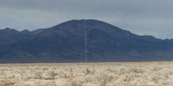
^Meteorological tower in the Spring Valley site, measuring wind.
Two public meetings: Tuesday, Jan. 5, 2010, at the Bristlecone Convention Center, 150 6th Street, in Ely, Jan. 6, 2010, at the Great Basin National Park Visitor Center, 53 North Highway 487, in Baker. 6 p.m. to 8 p.m.
Swamp Cedars Habitat
Next we drove with BLM to Swamp Cedar ACEC next to the proposed wind farm. The unique Swamp Cedars Area of Critical Environmental Concern lies on a "perched watertable," where seasonal wetlands and springs are common, and allowing a savanna of junipers to come down from their usual mountain habitats to grow on the valley floor. There is a lot of water in this basin, and the Southern Nevada Water Authority wants all of it to pipe down to Las Vegas.
The "cedars" are actually Rocky Mountain junipers (Juniperus scopulorum) growing on the flat valley floor among sagebrush and and ephemeral shallow marshes ("swamps").
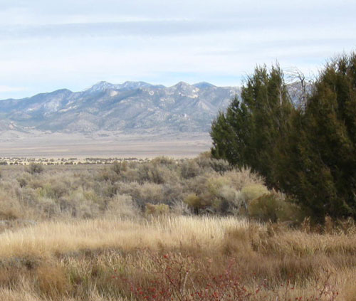
^Schell Creek Range in the distance. We noticed a Badger burrow here.
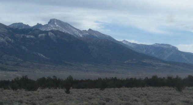
^Wheeler Peak as seen from the Swamp Cedars.
^Dry pools grown with meadow grasses (Deschampsia cespitosa) and rushes (Juncus spp.). Saltgrass (Distichlis spicata), Alkali sacaton bunches, and bluegrass (Poa sp.) also grow among the junipers. We have never seen a combination of junipers and such wetlands together -- a truly unique habitat.
^Lush grasses and rushes in marshy depressions. Mt. Moriah in the distance.
^A spring just west of the ACEC.
^Junipers.
^Saltgrass and junipers, on dried mud.
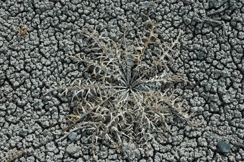
^A thistle (Cirsium sp.) rosette of leaves on dried mud. The wetlands are seasonal, and moister earlier in spring and summer.
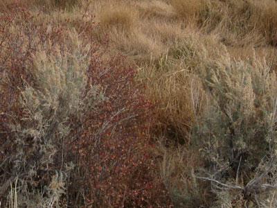
^Wild rose bushes (Rosa sp.) at the spring, their leaves turned reddish in the fall cold.
^Cattails (Typha sp.) at the spring, mixing with sagebrush and junipers.
A World Away: High Finance in Distant Cities
Like other alternative energy developers, Pattern Energy's near-term projects are dependent on federal government grants instead of tax credits as part of the federal stimulus package. The grants would give Pattern Energy cash up front for up to 30 percent of project costs. Pattern was formerly owned by Babcock & Brown, a global investment advisory firm founded in San Francisco in 1977, and headquartered in Sydney, Australia. In March 2009 it was unable to restructure its debt and became insolvent. US private-equity group Riverstone Holdings invested $400 million in the wind development branch, forming Pattern Energy out of the remnants of Babcock & Brown. New York-based Riverstone was set up in 2000 and now has about $17 billion under management across six investment funds, including the world’s largest renewable energy fund. Riverstone also invests in solar energy, geothermal, natural gas, oil, ethanol, and even logging interests.
(See San Francisco Business Journal).
REFERENCES:
Arnett Edward B. ; Brown W. Kent ; Erickson Wallace P. ; Fiedler Jenny K. ; Hamilton Va Brenda L. ; Henry Travis H. ; Jain Aaftab ; Johnson Gregory D. ; Kerns Jessica ; Koford Rolf R. ; Nicholson Charles P. ; O'Connell Timothy J. ; Piorkowski Martin D. ; Tankersley Roger D. 2008. Patterns of Bat Fatalities at Wind Energy Facilities in North America. The Journal of Wildlife Management vol. 72, no 1, pp. 61-78.
SWCA. 2009. Spring Valley Wind Biological Resources Report, Prepared for Spring Valley Wind LLC, Dallas Texas, by SWCA Environmental Consultants, Las Vegas, NV, May 19, 2009, obtained from the Bureau of Land Management Ely Field Office.
Sherwin, Richard E. 2008. A study on the use of Rose Guano Cave, Nevada by Mexican free-tailed bats (Tadarida brasiliensis). Report obtained from the Bureau of Land Management Ely Field Office.
HOME.....Updates......Great Basin National Park Photo Gallery