Project Canceled
February 3, 2012 - The proposed wind project near Virginia City, Nevada, was cancled by Bureau of Land Management, purportedly because of inaction by the company and lack of a Power Purchase Agreement with a utility. We suspect, however, the density of Golden eagle territories may have also played a part.
The project had been moved from an original location to the Virginia Range between McClellan Peak and Geiger Grade has been canceled, according to the Bureau of Land Management.
The New Comstock Wind Energy Project was an application by Great Basin Wind.
Storey County residents spoke out against the project at a hearing held in 2009.
Sources: personal communication with BLM and Record Courier.
New Comstock Wind Energy Project
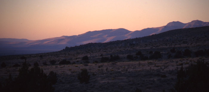
^The Virginia Range in northwestern Nevada, slated for possible wind industrialization.
December 14, 2008 - Virginia City, Nevada.
The Bureau of Land Management (BLM) announced plans on December 1 to assess the potential environmental impacts of a proposal to build a utility-scale wind farm on the mountains north of Carson City and just west of famed historic Virginia City in Washoe, Storey, and Lyon Counties. Great Basin Wind LLC submitted an application to BLM for a right of way to build an estimated 69 wind turbines capable of producing up to 192 megawatts of electricity on the sagebrush-covered ridges. The towers could be from 210 to 330 feet tall, each with three blades 115 feet to 170 feet long. BLM will be preparing an Environmental Impact Statement, and construction may not begin until 2010.
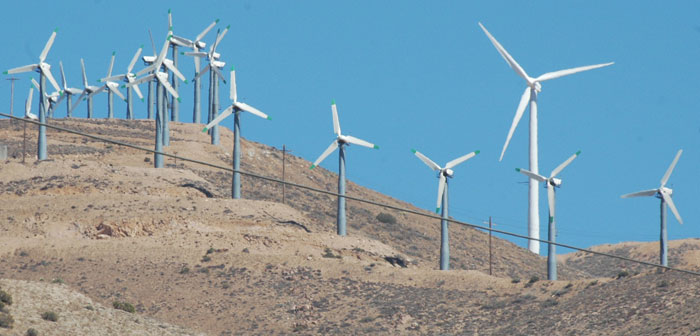
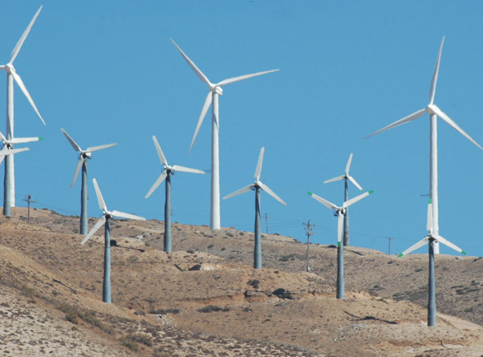
^Tehachapi Range wind farm in Kern County, California. Notice the graded roads and foundations dug into the ridge. Numerous powerlines of various sizes crisscross the mountain.
Industry Coming to Great Basin Ranges
Before we call this form of renewable energy "green" we should look at the impacts to the land. The wind farm will not just include the windmills. Roads 15 to 40 feet long will have to be "improved" according to the application notice, in order for the company to construct the wind towers. County planners said new roads built on top of the ridges to turbines would "most likely would not be seen from the valley floor". Underground transmission lines will be dug and 5 miles of new powerlines will be built to connect the farm to an existing power corridor along Highway 50. Storage yards, buildings, and "temporary work areas" will also be built during the six months of construction.
Access roads must be bulldozed and blasted out and heavy equipment must be moved to mountain ridges. Thousands of acres of habitat must be cleared. Topsoil and large rocks must be blasted away and removed to level the ridgetop. The entire mountain ridge becomes a vast construction site up to 15 or 20 miles long. Large foundations (over 60 feet square) are dug and blasted out, and thousands of yards of concrete are trucked up the mountain and poured. Oversize trucks then begin delivering the column and blade sections and giant cranes are moved from site to site as the structures go up.
Part of the wind project would fall inside the Virginia City National Historic Landmark and the Comstock National Historic District, which include the towns of Virginia City, Gold Hill and Silver City, active in Nevada's mining history. Gold and silver were discovered in 1859 at the "Comstock Lode", which set off a boom in the area, with 30,000 people living in the newly-built Virginia City by the 1870s. A classic boom-and-bust town, by 1890s the ore was played out, and folks moved on to other areas, but the wealth dug out of the mines here financed the construction of San Francisco. Today the area is a huge tourist attraction. How visible will this wind farm be from Virginia City? This could impact, degrade and change the character of the area forever.
An editorial appeared in the Las Vegas Review Journal on January 22, 2009:
The bullying tactics of big energy corporations in the name of green energy was illustrated by comments by Great Basin Wind, the company wanting to build the New Comstock Wind Energy Project, even in the face of opposition by local residents.
"'We're not against the windmills or alternative energy,' Storey County Planning Director Dean Haymore said Tuesday. 'We're just worried this isn't the place.'
"Virginia City resident Candance Silveria, in a letter to commissioners, said, 'The historical attraction of our area goes beyond the buildings, it is the entire visual experience that creates the atmosphere and ambiance so important to our livelihood.'
"The opposition didn't go over well with Rich Hamilton, president of Great Basin Wind, who argued that criticisms of the wind farm are 'overblown.' Besides, said Mr. Hamilton, residents will just have to get with the program and accept that wind turbines must be a part of the coming green energy wave.
"'We don't have Lewis and Clark anymore,' he told the Appeal. 'There are no longer resources over the next hill.'"
--We strongly disagree. LOCAL, POINT OF USE, DECENTRALIZED, DISTRIBUTED energy is potentially the future. See The Solution.
Get Involved!
BLM is preparing an Environmental Impact Statement and wants your comments. Scoping comments must be received by January 30, 2009.
You may e-mail comments directly to: newcomstockwind@blm.gov or visit their webpage and comment on their form.
See BLM's webpage on the project here>>.
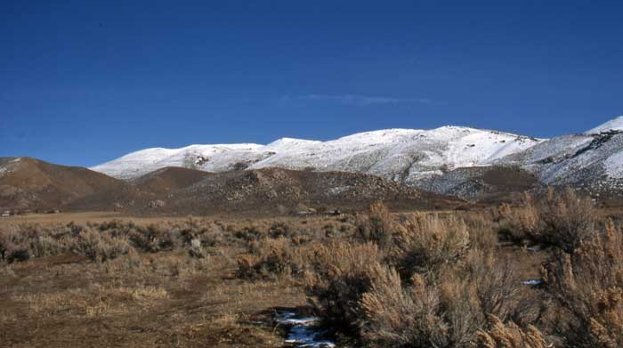
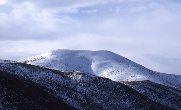
^Snowy Virginia Range. This is the ridge that would be lined with large wind turbines, within a few miles of Washoe Lake State Park and in view of the campground. Virginia City is on the other side and to the north.
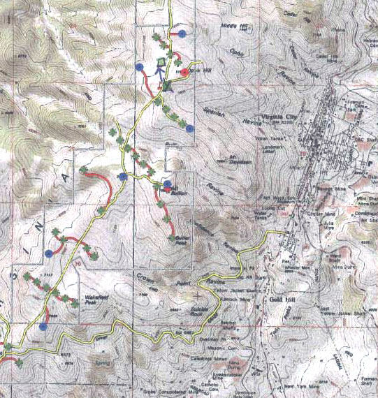
^Detail of BLM's map of the proposed New Comstock Wind Project next to Virginia City (to the right). The famous Comstock Lode gold mine complex, the richest in the country, is to the left of Virginia City, on the same ridge that the wind turbine construction will take place. The green crosses are proposed wind turbines; blue circles are meteorological towers; yellow lines are existing roads that will be widened; red lines will be new roads. Transmission lines between the turbines and down to the substation will be undergrounded in this part of the map.
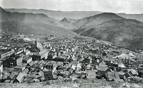
^Virginia City in 1861. Wind farms will be placed on the modern mountain to the upper left.
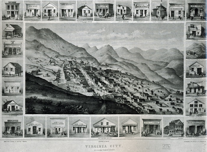
^Virginia City in 1875, with international hotels, churches, and "palatial saloons."
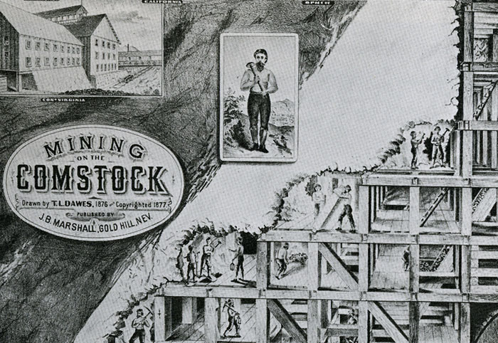
^Detail of a drawing showing the "set stoping" method of mining into soft ground invented and used in the Comstock Lode next to Virginia City. How will industrial wind farm construction built on this same ridge affect these historic mines?
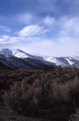
^Virginia Range and Big sagebrush in winter.
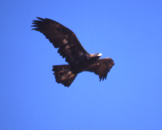
^Golden eagle: depending on location, raptors are prone to collision death with turbines. In a low avian activity area at Cordelia, California (Solano County), a single large wind turbine killed 54 birds in one year (Byrne, S. 1983. Bird movements and collision mortality at a large horizontal axis wind turbine. Cal-Neva Wildlife Transactions: 76- 83). The large Altamount wind farm, with ca. 5,000 wind turbines, has killed an estimated 40 to 116 Golden eagles per year (W. Grainger Hunt et al., Golden Eagles in a Perilous Landscape: Predicting The Effects Of Mitigation For Wind Turbine Blade-Strike Mortality, University of California, Santa Cruz. California Energy Commission Report, 2002, and Smallwood & K. Thelander, Developing Methods to Reduce Bird Mortality in the Altamount Pass Wind Resource Area, Aug. 2004 - www.energy.ca.gov/pier/final_project_reports/500-04-052.html).
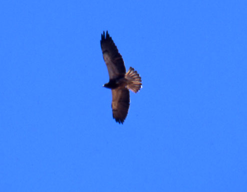
^Swainson's hawks also inhabit the valleys and ridges of western Nevada, and may also face annual kill rates from wind farms.
^Wind turbines - a threat to Great Basin raptors.
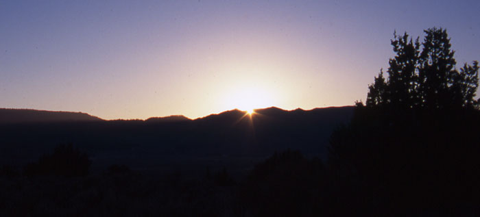
^Sunrise over the ridge with juniper.
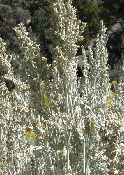
^Flowering stalks of Big sagebrush (Artemisia tridentata).
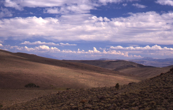
^Summer sagebrush hills, home of the Sage grouse.
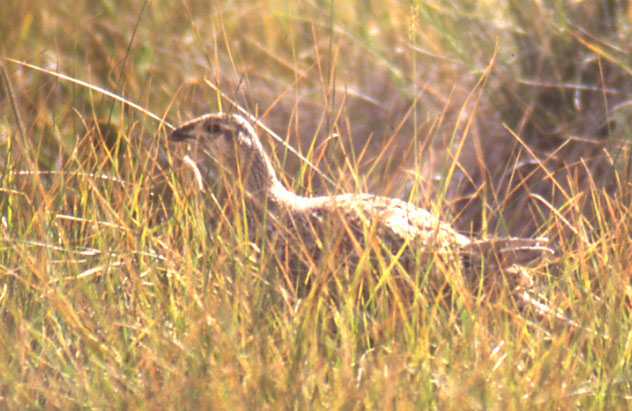
^Sage grouse hen. These shy birds have declined across their range due to habitat fragmentation and destruction of their preferred mosaic of dense sagebrush patches and meadows.
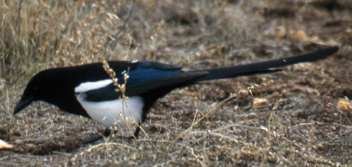
^Black-billed magpie.
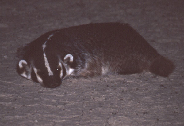
^Badger at night, a common fur-bearer of Great Basin mountains and basins.
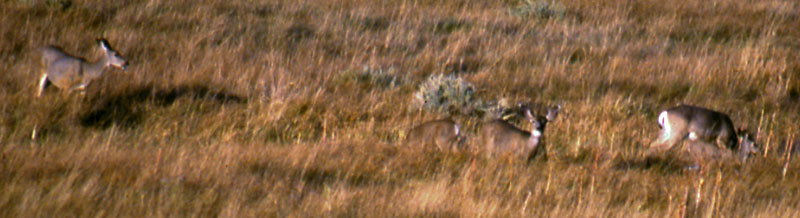
^Great Basin Mule deer does feeding in a mountain meadow.
^Sunset in the sagebrush and juniper.