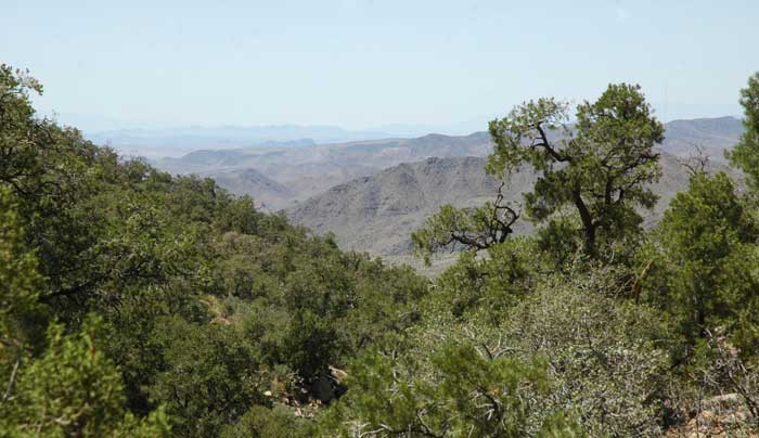
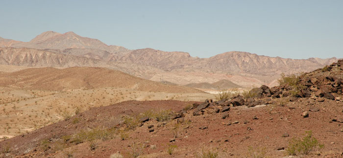
^View looking northwest from Mt. Tipton Wilderness in the Cerbat Mountains of Arizona. The proposed wind farm would lie on Bureau of Land Management land on the White Hills in the mid-range distance. On the far horizon lie the Black Mountains and Mount Wilson Wilderness, mostly within Lake Mead National Recreation Area along the Colorado River.
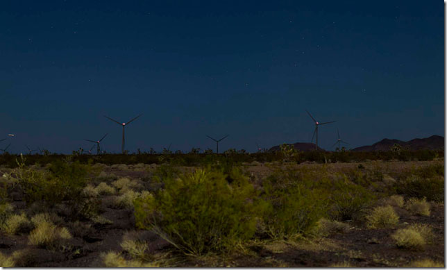
^ This dark sky visual simulation comes from the Final Environmental Impact Statement. The visual disturbances will be visible 27/7.
Final Environmental Impact Statement Released
May 17, 2013 - The Bureau of Land Management has releast the Final Environmental Impact Statement (FEIS) for the Mohave County Wind Farm Project.
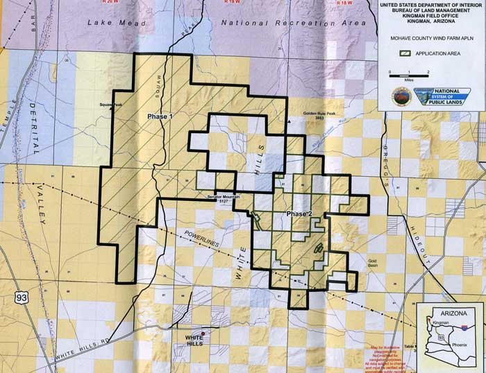
BP Wind Energy North America Inc., submitted right-of-way applications to the Bureau of Land Management (BLM) and the Bureau of Reclamation (Reclamation) to construct, operate, maintain and decommission a wind energy facility and associated infrastructure in the White Hills area of northwestern Mohave County, Arizona. BP Wind Energy applied to Western Area Power Administration to interconnect the proposed project to one of two transmission lines crossing the Project Area. The proposed wind farm site would occupy 38,099 acres of public land managed by the BLM, Kingman Field Office, and 8,960 acres of Federal land managed by the Reclamation. The proposed Project would produce up to 500 MW of power. This Final Environmental Impact Statement (EIS) analyzes in detail the environmental effects of five alternatives:
Alternative A – proponent’s proposed action
Alternative B – a reduced wind farm site footprint that encompasses approximately 30,872 acres of BLM-managed land and 3,848 acres of land managed by Reclamation
Alternative C – a reduced wind farm site footprint that encompasses approximately 30,178 acres of BLM-managed land and 5,124 acres of land managed by Reclamation
Alternative D –No Action, in which BLM would not authorize construction and operation of the wind energy facility
Alternative E – a reduced wind farm site footprint that encompasses approximately 35,329 acres of BLM-managed land and 2,781 acres of land managed by Reclamation
These alternatives were developed in response to issues and concerns raised during scoping and in response to comments on the Draft EIS. The agencies’ preferred alternative is Alternative E – a reduced footprint that combines elements of Alternatives A and B. BLM, Reclamation, and Western will not issue Records of Decision, making a decision on the Project or interconnection, for at least 30 calendar days following the date the U.S. Environmental Protection Agency publishes its Notice of Availability in the Federal Register.
Draft Environmental Impact Statement Out
May 4, 2012 - The Bureau of Land Management is considering granting a 47,000-acre right-of-way to BP in northwestern Arizona. This is a priority project and the public is only given 45 days to submit comments.
http://www.gpo.gov/fdsys/pkg/FR-2012-05-04/html/2012-10749.htm
Notice of Availability of the Draft Environmental Impact Statement for the Proposed Mohave County Wind Farm Project, AGENCY: Bureau of Land Management, Interior.
DATES: To ensure comments will be considered, the BLM must receive written comments on the proposed Mohave County Wind Farm Project Draft EIS within 45 days following the date the Environmental Protection Agency publishes its Notice of Availability in the Federal Register. The BLM will announce dates and locations of future meetings or hearings and any other public involvement activities at least 15 days in advance through public notices, media releases, mailings, and the BLM Web site at
http://www.blm.gov/az/st/en/prog/energy/wind/mohave.html.
ADDRESSES: You may submit comments related to the following Mohave County Wind Farm Project by any of the following methods: Web site:
http://www.blm.gov/az/st/en/prog/energy/wind/mohave.html. Email:
KFO_WindEnergy@blm.gov. Fax: 602-417-9490. Mail: Bureau of Land Management, Renewable Energy Coordination Office, Arizona State Office, One North Central Avenue, Suite 800, Phoenix, Arizona 85004-4427.Copies of the Mohave County Wind Farm Project Draft EIS are available in the Arizona State Office at the above address; in the Kingman Field Office located at 2755 Mission Boulevard, Kingman, Arizona 86401; and on the above Web site.
FOR FURTHER INFORMATION CONTACT: Or to have your name added to our mailing list, contact Jerry Crockford, BLM-contracted project manager, telephone 505-360-0473; email KFO_WindEnergy@blm.gov; or contact Jackie Neckels, Environmental Coordination, telephone 602-417-9262; address Bureau of Land Management, Arizona State Office, Renewable Energy Coordination Office, One North Central Avenue, Suite 800, Phoenix, Arizona 85004-4427.
SUPPLEMENTARY INFORMATION: The lead Federal agency for the Mohave County Wind Farm Project is the BLM Kingman Field Office. Cooperating agencies are the Western Area Power Administration (Western); Bureau of Reclamation--Lower Colorado Region (Reclamation); National Park Service--Lake Mead National Recreation Area; Mohave County, Arizona; Arizona Game and Fish Department; and the Hualapai Tribe Department of Cultural Resources. The applicant, BP Wind Energy North America (BPWE), applied for a right-of-way to construct, operate, maintain, and decommission a 500-megawatt (MW) wind farm, including turbine generators and associated infrastructure, on approximately 38,099 acres of land managed by the BLM and approximately 8,960 acres of land managed by Reclamation, totaling approximately 47,059 acres of Federal land.
The project area is located in the White Hills area approximately 40 miles northwest of Kingman, Arizona, approximately 9 miles south of the Colorado River, and approximately 20 miles southeast of Hoover Dam. A map of the proposed project area and a legal description are available on the BLM Web site at
http://www.blm.gov/az/st/en/prog/energy/wind/mohave.html.
The project is anticipated to generate up to 500 MW of electricity. It is proposed to consist of up to 283 turbines, access roads, and ancillary facilities. The turbine generators would be selected from those with a power output ranging from 1.5 to 3.0 MW each. To the extent possible, existing roads would be used to reduce potential impacts associated with the construction of new roads. Roads would be improved as needed, and the road network would be supplemented with internal access/service roads to each wind turbine.
Updates
September 18, 2011 - In April 2010 the Bureau of Land Management issued an update on the Mohave County Wind Farm Project proposed by BP Wind Energy, stating that a section of more than 7,000 acres of private and public land is no longer under consideration for the second phase of the project. BLM Project Manager Jerry Crockford said additional studies have shown that the phase 2 area, located to the east of the main project, does not have the wind resources that BP and the BLM thought it had. The project may also conflict with mining claims in the area, he said.
Instead of using the 7,000 acres of private and public land originally designated for phase 2, the project will use between 31,300 to 40,300 acres of BLM land and about 9,000 acres of Bureau of Reclamation land to the west of the project.
The newsletter also states that BP and the BLM are considering a partnership with Hualapai Valley Solar to create one connection point for both energy plants, with one of the electrical transmission lines running through the area.
http://kdminer.com/Main.asp?SectionID=1&SubSectionID=1&ArticleID=37642
A September 2011 Mohave County Landowner's Association newsletter (printed) had more recent updates. The Draft Environmental Impact Statement is expected to be made public in late 2011, and the Final EIS by summer 2012. Final approval could come in Fall 2012.
The entrance to the project would be along Highway 93 at milepost 22. Up to 110 miles of roads will be constructed. Eight meteorological towers are in place. The project may cost $1 billion to build.
Heart of Wilderness
November 22, 2009 - Mojave County, 40 miles northwest of Kingman, Arizona -
BP Wind Energy North America has been studying the wind in this corner of Arizona for four years, according the the Bureau of Land Management, and it now wants to go ahead with a large wind farm on the fan and ridges of the White Hills area. Turbines, new access roads, operations and maintenance buildings, powerlines, and substations would be constructed if the Right-of-Way permit is issued. 335 wind turbines would be built on 42,420 acres of public land plus an additional 4,360 acres of private land (which may or may not yet be negotiated). The maximum capacity is said to be 500 megawatts (MW), although wind energy typically produces mush less. Each turbine is proposed to be 1.5 to 3 MW each.
Underground 34.5 kilovolt (kV) electrical cables would connect the turbines with a 345 or 500 kV substation. Then either a 345 or 500 kV overhead transmission line would be built to a new switchyard to interconnect to one of two exiting major transmission lines cutting through the area.
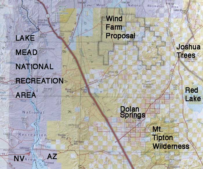
^Detail of the proposed Mojave County Wind Farm on the White Hills area; map sent to us by BLM Kingman district office. White squares are private land.
BLM is gathering public comments in their scoping process to prepare an Environmental Impact Statement for this remote wind energy project. The deadline is January 4, 2010. [Federal Register: November 20, 2009 (Volume 74, Number 223), Page 60289-60290 - wais.access.gpo.gov]
Send comments to:
Ruben Sanchez, Field Manager
BLM Kingman Field Office
2755 Mission Boulevard
Kingman, AZ 86401
928-718-3700
e-mail: KFO_WindEnergy@blm.gov
Ask BLM for the Plan of Development for this wind project, as it has not been made available to the public. It should be on their website by now. Ask to have the comment period delayed so the public can have adequate time to review this project.
[Federal Register: November 20, 2009 (Volume 74, Number 223), Page 60289-60290, wais.access.gpo.gov]
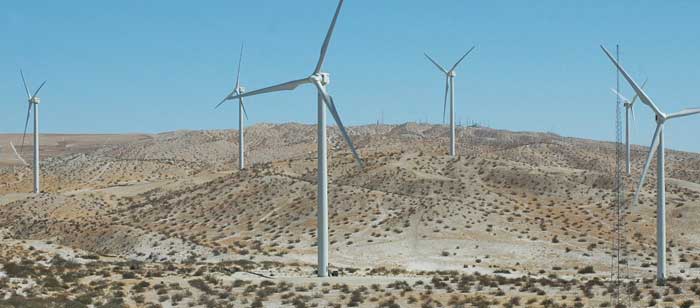
^Edom Hills wind farm near Palm Springs, California, on Colorado Desert hills.
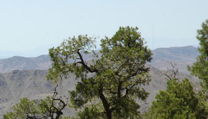
^Meteorological tower barely visible on distant White Hills to right in this photo we took while hiking up Mt. Tipton, looking through the Pinyon pines.
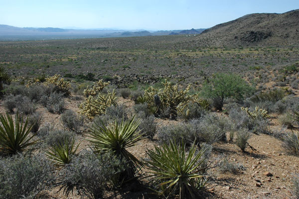
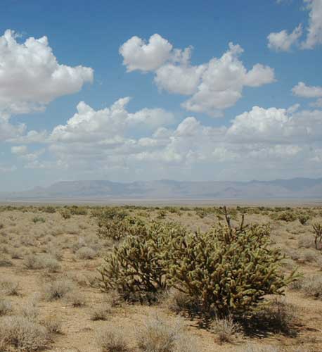
^Fan with Mojave Desert habitat of Blackbrush, Mojave yuccas, Catclaw acacias, and Buckhorn chollas, looking northwest towards Dolan Springs and the proposed project site.
^Catclaw acacias are common in washes of the foothills, and in Detrital Valley.
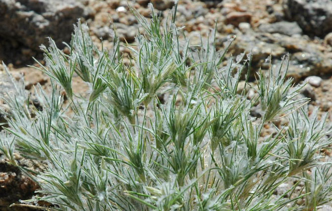
^Lush Fluffgrass after summer rains, a favorite Desert tortoise food.
Condor Flyways
California condors (Gymnogyps californianus) are being actively reintroduced into Grand Canyon National Park, east of the project site, and since the first release in 1996 the huge birds have been wandering into Utah and Nevada, including a recent sighting at Gold Butte, a mere 50 miles north of the wind project site. Collisions kills would be a big worry for birds flying by the tall wind turbines.
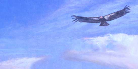
(Oil painting copyright LMC 2009)
Bat and Bird Mortality from Turbines
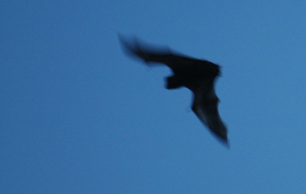
^Hoary bat flying at dusk. Bats may suffer severe mortalities as they collide with giant wind projects when the breezes pick up at night.
Michael Fry, director of conservation advocacy for the American Bird Conservancy, says:
"In addition to habitat issues, bird collisions with wind turbines are mounting. It may look like those blades are spinning lazily in the breeze, but their tips can reach speeds of 200 mph (for a 198-foot blade spinning at 15 revolutions a minute). The inevitable result is that birds and bats strike the blades, with estimates of as many as 11 birds killed by each turbine a year. Eagles, hawks and falcons are particularly susceptible as they hunt along ridge tops or in open areas.
"Environmentalists and the wind industry have been discussing for several years how to protect birds, bats and wildlife habitat while allowing development to continue. Not surprising, there have been conflicts along the way." (From the Windsor Star >>here.)
The Bats and Wind Energy Cooperative, a research group formed of such entities as Bat Conservation International, the US Fish and Wildlife Service, and National Renewable Energy Laboratory of the US Department of Energy, says:
"Unexpectedly high numbers of bat fatalities reported at wind energy sites, especially those on ridge tops in the eastern United States, have heightened the urgency to understand problems and find solutions."
We note that bat mortality studies at western wind turbine sites have barely been undertaken -- many studies are planned for "after the fact," after wind farms have been built and the deaths occur. See our page on Bats and Wind.
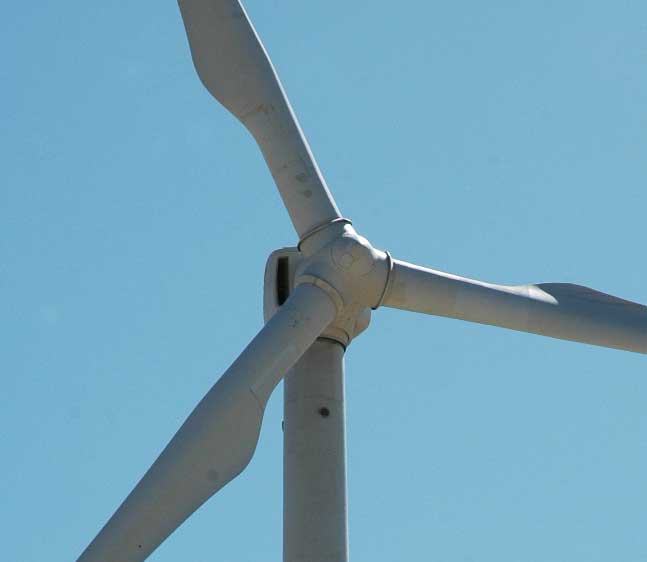
^Huge turbine 300 feet up in the sky.
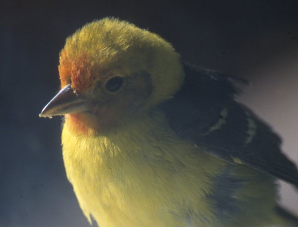
^Also in danger of wind turbine collisions? Dozens of species of small passerine birds, such as this Western tanager, migrate along the ridgelines and valley acacia washes where this proposal lies.
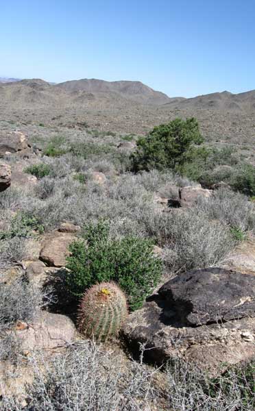
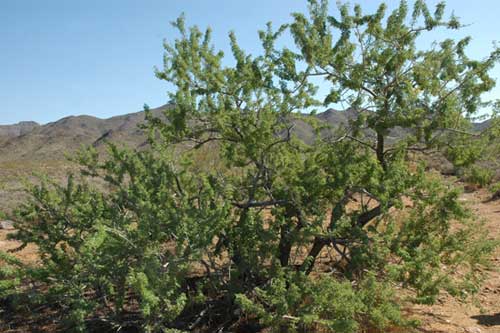
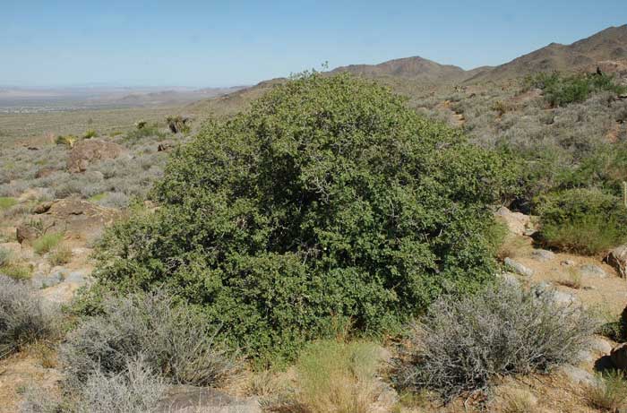
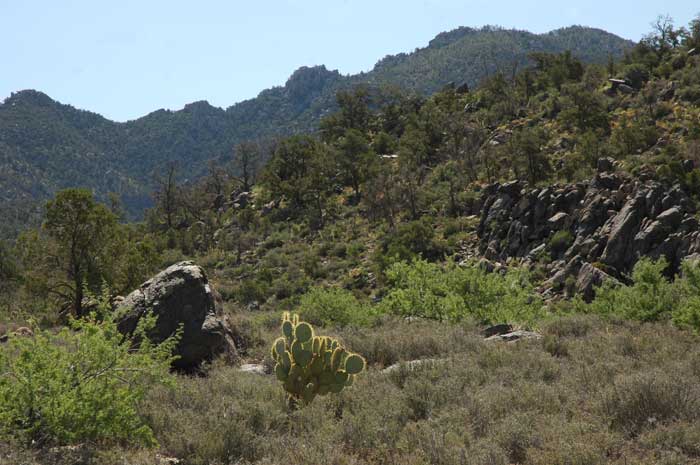
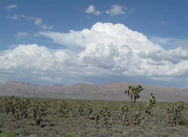
^Foothills of the Cerbat Mountains, just south of the wind project proposal, with Barrel cactus, Blackbrush, and scattered Pinyon pine.
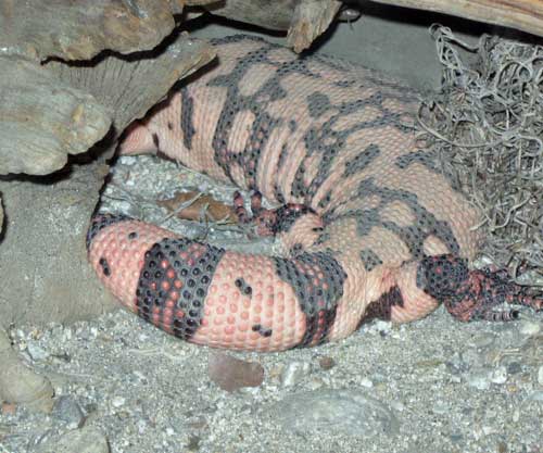
^The region is in the core range of the Gila monster (Heloderma suspectum), a secretive reptile that spends more than 90% of its time underground. Large wind turbines typically require cement foundations dug 10 feet down into the ground, and dozens of feet in diameter, to anchor the tall steel structures.
^Scrub oak (Quercus turbinella) on the slopes of the hills above Dolan Springs, Arizona.
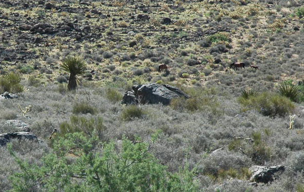
^We found wild mustangs grazing on the lower slopes of the Cerbat Range just to the south of the site in summer 2009.
On the Boundary of Lake Mead National Recreation Area
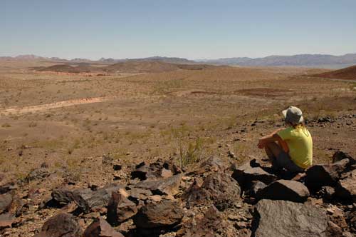
^Hiker enjoys the view of the low desert by the Colorado River.
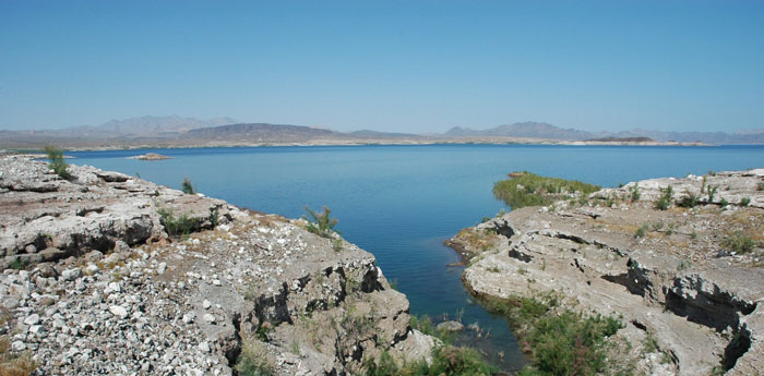
^Lake Mead on the Nevada side looking east toward Arizona. The wind energy proposal lies about 20 miles southeast of Hoover Dam.
^Colorful mountains in Lake Mead National Recreation Area.
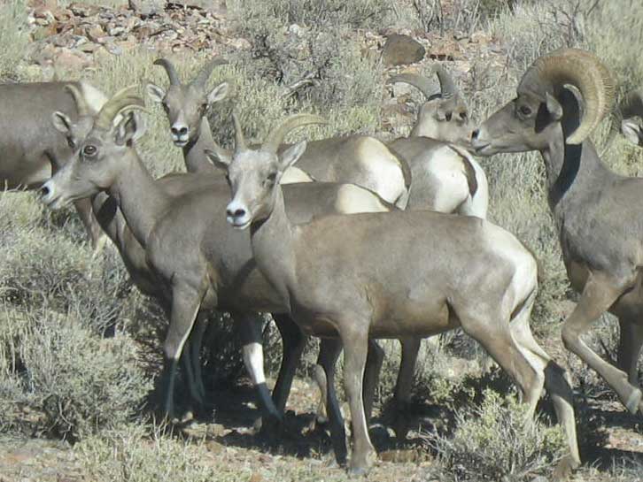
^Desert bighorn sheep occupy many parts of Lake Mead National Recreation Area in Arizona.
Mount Tipton Wilderness Next Door
Mount Tipton Wilderness occupies the highest part of the Cerbat Range just south of the wind proposal, near Dolan Springs, Arizona. It covers 30,760 acres of upper-elevation Mojave Desert scrub, Pinyon-Juniper woodland, Scrub oak thickets, and a small grove of Ponderosa pines on the peak at 7,148 feet. The mountain is a "sky island" of trees in an arid landscape.
We took a hike here in the summer of 2009 >>here.
Amazing Joshua Tree Woodland to East
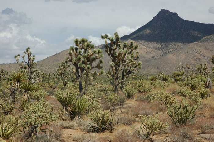
^Hualapai Valley Joshua Trees, east of the proposed wind project.
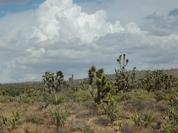
^Joshua trees, Mojave yuccas, and Buckhorn cholla grow dense on the slopes, bajadas, and valleys.
^Large Joshua tree woodland on the way to Meadview, Highway 25. The Grand Wash Cliffs rise in the distance, towards the Grand Canyon. This is about 10 miles northeast of the wind project proposal.
Solar Thermal Projects Also in Kingman Area
^East of Mt. Tipton and the White Hills, Buckhorn chollas fill the valley looking toward the Grand Wash Cliffs. Red Lake lies in the distance.
Mojave County is seeing its own land rush for solar power too.
Hualapai Valley Solar's 340 megawatt plant would be located on a privately owned 4,000-acre parcel 27 miles north of Kingman at Red Lake, on the east side of Mt. Tipton. It would be a parabolic trough solar thermal plant with molten salt storage, and would purportedly cost $2 billion to build. Water issues are a strong worry for this proposal, as for all projects like this in the deserts.
The county board also approved Spanish-based Albiasa's 200 megawatt parabolic trough solar thermal project on a 3,000-acre parcel of land located about 15 miles east of Kingman. It would also have molten salt storage, a technology still in its infancy. This project would lie in Round Valley east of Hualapai Mountain Park, by Highway 93, south of Interstate 40.
From November 17, 2009 article in ABC15.com Arizona >>here. See also CleanTechnica.com >>here.
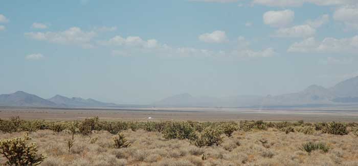
^Red Lake playa in Hualapai Valley, looking north.
All photographs Copyright 2009 Basin and Range Watch.
HOME.....Searchlight Wind Energy Project.....Mt. Tipton Wilderness Hike
Hoary Bat Ecology and Wind Turbine Mortality.....May 2010 BLM Update