Gold Trouble
February 16, 2010 - Reward Mine Gets Permit.
Nevada Division of Environmental Protection issued a Reclamation Permit for the Reward Mine that became effective February 7, 2010. The permit will allow Atna to begin construction of the Reward Mine.
Infrastructure development will now begin: access road improvements, fencing, and placement of orders for long lead-time items, power line and water supply development. Anticipated cost for this phase of work will be approximately $3.0 million over six months.
Phase 2 activities will include the construction of leach pad facilities, purchase of a semi portable crushing plant, and installation of office, lab, and shop facilities. Pre-stripping of mine waste would also begin. Timing on this construction phase dependend on availability of free cash flow from our Briggs Mine operation, availability of equipment, and staffing.
From PR Newswire at Yahoo Finance >>here.
April 12, 2009 - Bare Mountains, Nye County, Nevada
Reward Mine Environmental Assessment - comments due by April 30 >>Southern Nevada BLM.
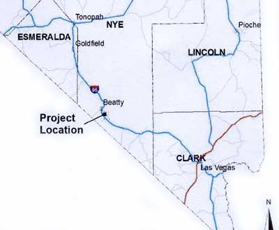
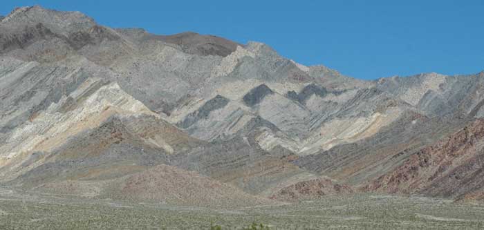
Zigzags of colorful banded whitish quartzite, gray limestone and dolomite, and weathered brown rocks make up the west face of the Bare Mountains, greeting the car traveler along Nevada's US highway 95 eight miles south of the town of Beatty. Home to trophy Desert bighorn rams that hunters wait years to get lottery tags for, Desert tortoises, and a limestone endemic flora.
But this area holds small underground deposits of gold as well, and was part of the boom of the early 20th century Bullfrog mining district. With gold prices fetching large prices today, CR Reward Corporation (CRRC) wants to blast the overlying rock away and stripmine the mountain slopes to get at it. This is the same company that owns the Briggs Mine in Panamint Valley, Inyo County, California.
An estimated 6.8 million tons of processed ore and 13.98 million tons of waste rock will be dug out of the mountain to get at approximately 163,506 ounces of gold-bearing ore. A small amount of silver would also be extracted.
CRRC holds claims on an area of 2,006 acres, of which 1,786 acres are public lands and 220 acres are private lands. 287
acres would be used for the project. The current plan includes mining for four to five years of ore removal and processing, and three to five years for reclamation and closure activities.
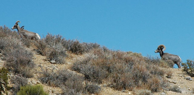
^Desert bighorn sheep in the Bare Mountains at nearby Specie Spring.
Gold was discovered on the site in 1913. The 10 acres of disturbance from the historic Gold Ace Mine is visible on the project site, and will be excavated into a larger 5.3-acre pit if the Reward Mine is approved. The proposed Reward open pit would be approximately 3,500 feet in length by 800 feet in width, with a plan view area of approximately 47.6 acres. The general pit depth would likely to range from about 300 to 500 feet. Blasting would occur two to five times per week.
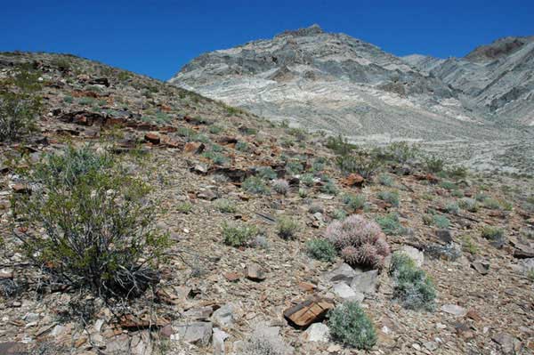
14 million tons of waste rock would be produced during the five years of mine operation, covering 117 acres in three areas. Waste rock would be backfilled into the Gold Ace pit, covering it. More rubble from the second larger pit will be poured onto the desert hill slope burying a habitat of Creosote, Cottontop cactus, and Chaffbush, where we found several recent Bighorn sheep beds.
350 tons of ore per day would be transported by haul trucks to a conveyor belt, feeding into ore crushers, and then to the heap leach facility.
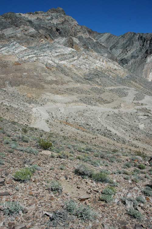
^A Bighorn sheep bed in the foreground slope, with the mine pit site beyond (full of new roads and test pit locations where the mining company explored for the gold underground. Waste rock would be dumped on this bighorn bedding area.
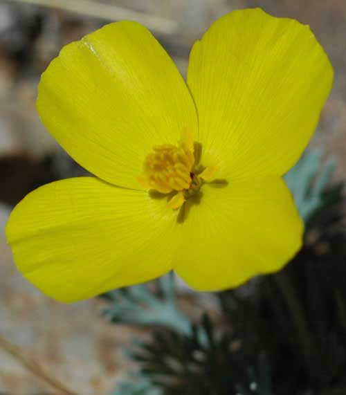
^Desert gold poppy.
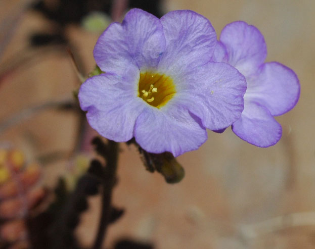
^Fremont phacelia blooms.
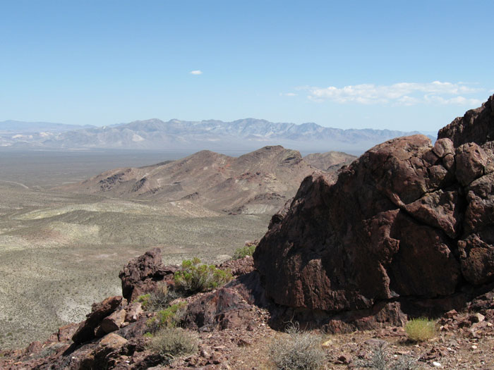
^View of the distant west slope of the Bare Mountains from Daylight Pass hills in Death Valley National Park, across Amargosa Valley. The Reward site lies in the middle of the distant range.
Water
Water would be provided from a newly constructed well located on the east side of US Highway 95. The drawdown or cone of depression would result up to two miles diameter from the pumping at 80 years after the cessation of mining.
Carrara and Tungsten Canyons create washes next to the mine site during storms. These connect with the Amargosa River channel, which is typically dry. But in July 1990, the Amargosa River flooded in a massive storm event, reaching approximately 83,000 gallons per minute at three miles south of Beatty. The Federal Emergency Management Agency (FEMA) said the Project had a moderate flood hazard because of such storm events. The mining company says it will construct berms and ditches to shield the mine area from any floods that would wash potential toxins into the Amargosa River.
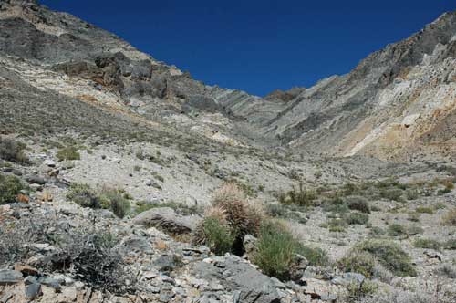
^Steep canyon and wash next to the Reward site.
Carbonate aquifers underlay the broad basins. BLM says, "the exact elevation of the groundwater table within the Project area is not known; however, it is well beneath the level of the proposed pit development. More than 290 exploration drill holes in the Project area failed to encounter the carbonate aquifer between the surface and elevation 3,400 feet amsl."
The EA states that 93 million gallons of water will be used each year which is over 300 acre feet. The EA fails to recognize the recent Wild and Scenic designation of the lower Amargosa River in California which the BLM is required to analyze the effects of projects up river. Given the water withdrawal of over 300 acre feet per year and the potential for toxic sediments from potential flash floods, this should be a concern.
Death Valley National Park has had concerns that its water is will be affected by up-gradient withdrawals and contamination. The Death Valley groundwater flow system is believed, by the National Park Service, to be fully, if not over, appropriated. Existing and future appropriations of limited water resources from the flow system may result in impacts to Park water
resources. Additionally, potentially contaminated groundwater plumes from cyanide runoff from the large mining operation near Bullfrog could contaminate the regional
aquifer that drains into the Park (NPS 1988, in Inyo County Master Plan).
Air and Water Pollution
See page 2 >>here.
Reclamation
The EA says: "Due to the poor quality and limited quantity of soils in the Project area for reclamation, revegetation may not be successful."
The 47-acre open pit would "not be revegetated." The EA claims the reclaimed areas would take about 10 years to revegetate, but we have seen similar mine dump areas not restored to native conditions for much longer than this. Reseeded Four-wing saltbush (Atriplex canescens) is usually the only shrub to pioneer these hills of raw crushed rock, and even then the density of vegetation only attains less than 10% on other mine reclamation projects in the Bare Mountains and Bullfrog Hills.
"Cacti removed from the footprint of planned facilities prior to construction would be transplanted onto reclaimed surfaces as appropriate." We will watch to see if and how this happens. Some cacti may be sold according to the EA.
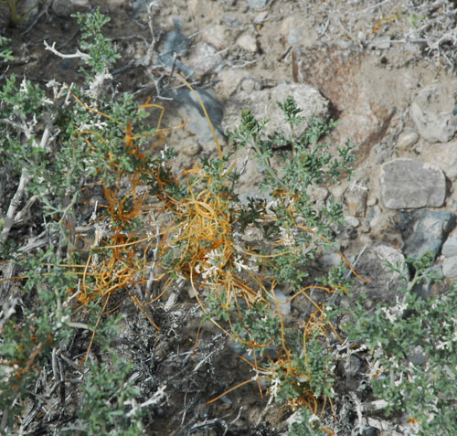
^Indigo Bush with parasitic Dodder.
Carrara Ghost Town
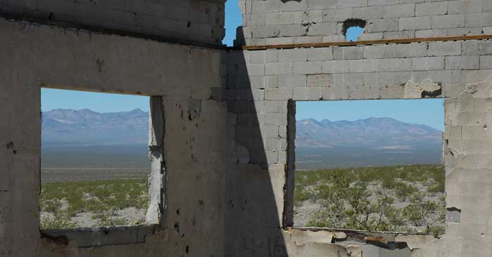
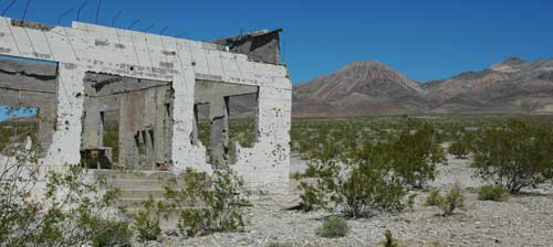
This ruin was laid out in 1911 to 1913 by the American Carrara Marble Company to access a large marble quarry in the hills east of the townsite. Carrara lay on the fan below the Reward Mine site, along the tracks of the Las Vegas & Tonopah Railroad. It once had a post office, hotel, restaurant, store and even a swimming pool and town fountain, that served about 150 residents. The town was named after Carrara, Italy, famous for its marble.
The quarry contained high quality marble, but it fractured too easily so the mine eventually closed. Most of the population was gone by 1924. But then gold was discovered...
We saw three tourists stopping in an afternoon to take a look at the old buildings.
The EA does not mention the potential effects blasting would have on the nearby structures of the Carrara Ruins. These buildings are close to 100 years old. Will vibrations from blasting harm these structures and if so, how would they be stabilized? The ghost town of Rhyolite is having severe problems with buildings collapsing.
Western Shoshone Land
The area lies within the Western Shoshone Homeland. BLM says, "There was no ethnographic information found to indicate a potential for traditional cultural rites or any other significant prehistoric sites...There was nothing to indicate the potential for sensitive Native American sites."
This was not the reaction from the Timbisha Shone we talked to about the potential mine. They were very concerned about it. The BLM had contacted the Timbisha, who were concerned about how the mine would affect the ecosystem, and if it might release pollutants into the land and water.
Visual Resources
BLM says the " level of change to the characteristic
landscape should be moderate. Management activities may attract attention but should not dominate the view of the casual observer. " This, of course, is completely subjective, and for those of us who hike on such slopes and search out wildflowers, insects, and glimpses of Bighorn sheep, the views would be devastated.
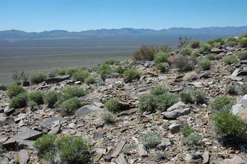
^This hill with Chaffbush would be obliterated by mined waste rock dumps.
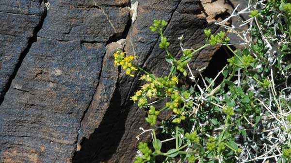
^Chaffbush flowering.
Rare Plants and Animals
Flawed biological surveys are evident in the EA, listing species such as Teddybear cholla (Cylindropuntia bigelovia), Lesser earless lizard (Holbrookia maculata) (this species does not even occur in Nevada), and Mojave fringe-toed lizard (Uma scoparia)
(which requires fine grain sand dunes at elevations lower than the Reward Site; they are not found north of the Ibex Dunes in Death Valley National Park).
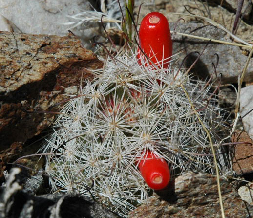
^A very small Mammillaria cactus pokes through the rocks, with fruits ripe. This will be buried by waste dump rock from the pit.
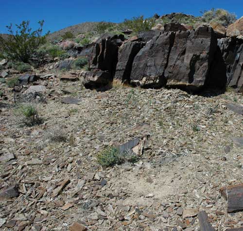
^Bighorn bed on the slope that will be covered with millions of tons of waste rock.
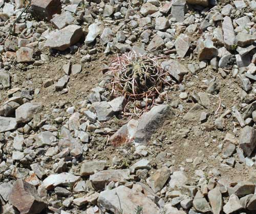
^Bighorn apparently pawed at this Cottontop cactus.
Bare Mountain supports one of the healthiest populations of Desert bighorn sheep (Ovis canadensis nelsoni) in the state of Nevada.
After a visit to the site, we identified several active signs of bighorn sheep. A guzzler located just a half mile from the site supports a healthy, breeding population of sheep. The bighorn sheep have two lambing sites in the mine project area.
There is no mention by BLM of the potential effects that the noise and vibrations from blasting would have on sheep during rutting season, lambing season and the hottest times of year.
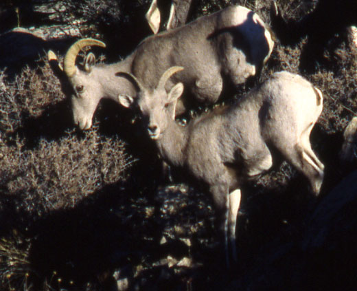
^Desert bighorn favor Blackbrush shrubs as forage.
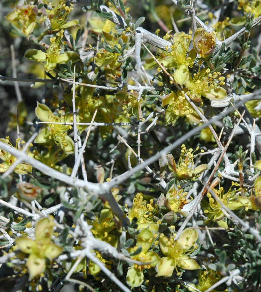
^Blackbrush shrubs flowering.
Desert tortoises (Gopherus agasizzii) currently inhabit the area, although the EA claims the density is low, and that "rocky terrain and steeper slopes are not preferred habitat for this species." But Desert Tortoise actually do use rocky slopes.
The EA does not examine potential effects of heavy metals and toxins to desert tortoise left in the project area over an extended period of time (or to humans for that matter).
Tortoise exclusion fence would be constructed and 182 acres
of possible tortoise habitat would be removed. Pre-construction clearance surveys would be done, and tortoises relocated to tortoises nearby areas. "However, not all tortoises would be found during clearance surveys and there is potential for direct impact to tortoises during construction of the Project or
during normal site activities."
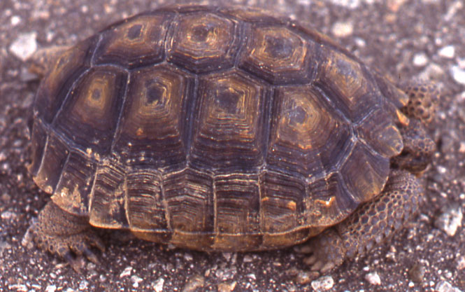
Chuckwallas (Sauromalus obesus) live i these rocky outcrops, and the mining activities would result in "killing and burying" many of them.
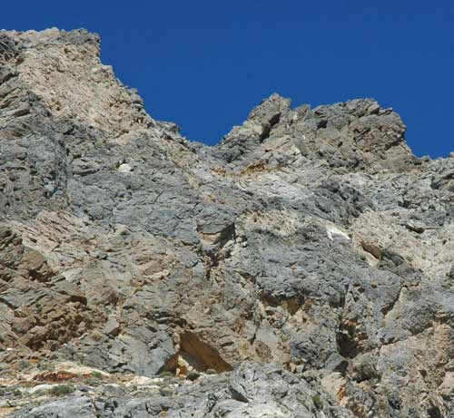
^Cliff above the pit site where we heard Prairie falcons calling.
Hiking by the huge white quartzite-dolomite cliff face which would be excavated into a pit, we heard the screaming calls of a pair of Prairie falcons (Falco mexicanus) high above. They perched on the cliff top watching us. How will they be affected by this mine?
The project site could also be suitable habitat for Townsend's big eared bats (Plecotus townsendii) and Burrowing owls (Athene cunicularia).
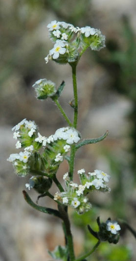
^Popcorn flower (Cryptantha sp.) on the future mine site.
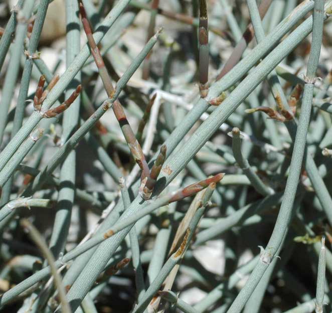
^The endemic Death Valley ephedra, growing right on the site of the planned pit.
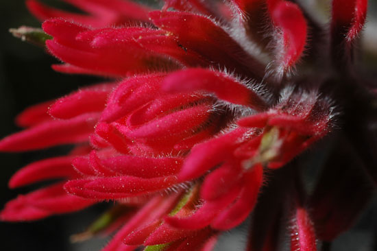
^Detail of Paintbrush flower.
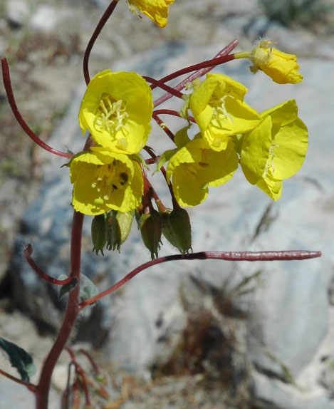
^Golden evening primrose.
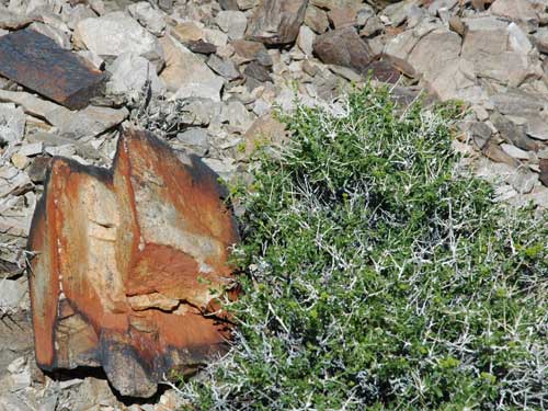
^Chaffbush on rocky slope.
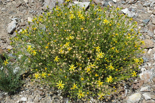
^Narrow-leaved goldenbush growing on a cliff which will be blasted if the mining operation is approved.
Reward Mine Environmental Assessment - comments due by April 30 >>Southern Nevada BLM.
Copy and paste our letter >>here.
^The future of the west slope of the Bare Mountains? Beatty Bullfrog Mine, played out and closed. More photos of nearby gold mine destruction on page 2 >>here.
Links:
Western Shoshone Defense Project
