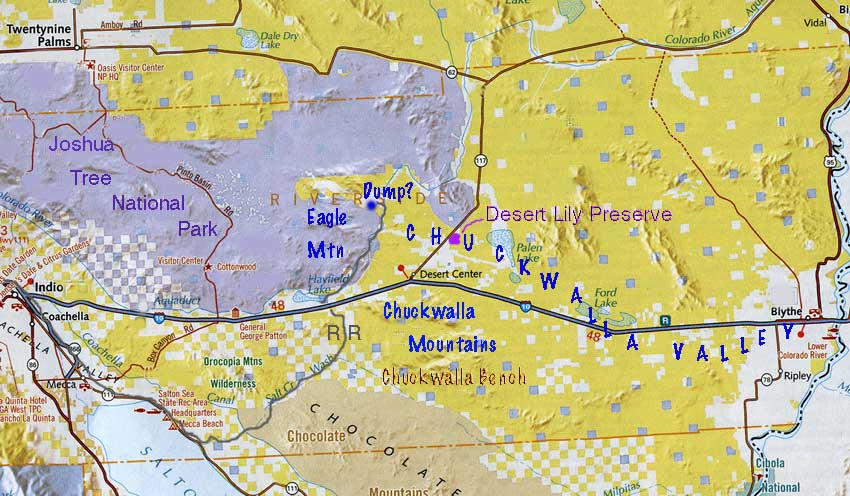
^The Chuckwalla Valley region. Yellow is Bureau of Land Management land.
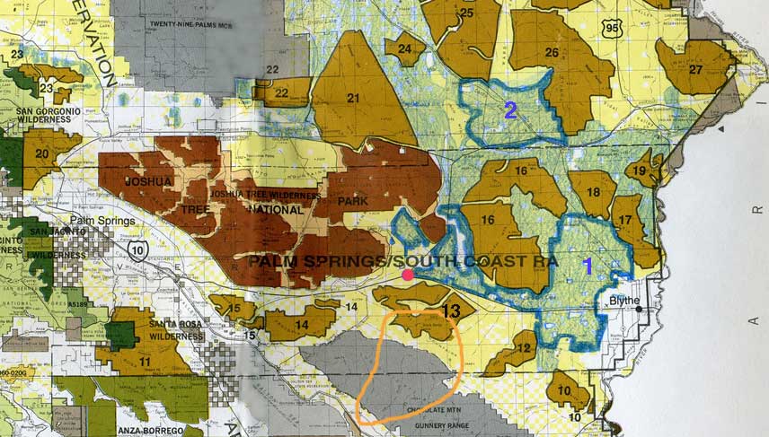
^Bureau of Land Management Wilderness map of the California Desert Conservation Area, southeastern desert region. Includes eastern San Bernardino, Riverside, and Imperial Counties. Notice how many wilderness areas would be totally surrounded by industrial solar energy developments in this plan, as well as the eastern boundary of Joshua Tree National Park.
Red dot = Desert Center
Orange oval outline = U.S. range of Munz cholla (it is also found in northeastern Baja California, Mexico).
Brown area = Joshua Tree National Park.
Solar Energy Study Areas (dark blue outline):
- 1 - Riverside East
- 2 - Iron Mountain
Light blue areas = BLM lands being analyzed for solar development (Source: Solar Energy Development Programmatic EIS Information Center at http://solareis.anl.gov/index.cfm, as of 6/5/2009).
Wilderness areas:
- 10 - Palo Verde Mountains
- 11 - Santa Rosa
- 12 - Little Chuckwalla Mountains
- 13 - Chuckwalla Mountains
- 14 - Orocopia Mountains
- 15 - Mecca Hills
- 16 - Palen/McCoy
- 17 - Big Maria Mountains
- 18 - Rice Valley
- 19 - Riverside Mountains
- 20 - San Gorgonio
- 21 - Sheephole Valley
- 22 - Cleghorn Lakes
- 23 - Bighorn Mountain
- 24 - Cadiz Dunes
- 25 - Old Woman Mountains
- 26 - Turtle Mountains
- 27 - Whipple Mountains
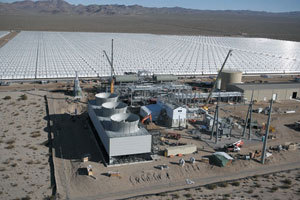
^Industrial concentrated solar power plant with parabolic trough mirrors covering thousands of acres.